
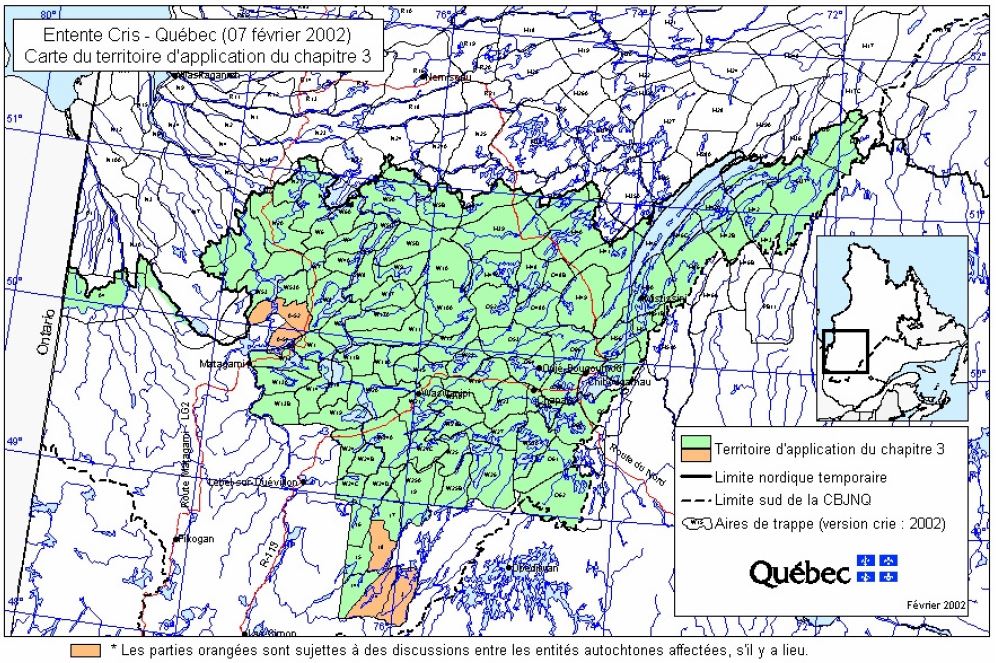
The Adapted Forestry Regime (AFR) applies on the territory defined in Schedule C-1 of the Agreement (Paix des Braves), within the boundaries of James Bay and Northern Québec Agreement (JBNQA) territory. It is bordered to the north by the northern limit of Québec’s commercial forest and spans 66 010 km2.
* Adjustments made in the context of the negotiations for the 6th amendment to the Paix des braves
It is occupied by five Cree communities and non-Native communities.
| Cree Communities | Non-Native Communities | ||
| Mistissini | 3 523 | Chapais | 1 499 |
| Nemaska* | 760 | Chibougamau | 7 504 |
| Oujé-Bougoumou | 737 | Lebel-sur-Quévillon* | 2 187 |
| Waskaganish* | 2 196 | Matagami* | 1 453 |
| Waswanipi | 1 759 | Eeyou Istchee James Bay Regional Government* | 1 303 |
*Outside the territory covered by Chapter 3
Click on the interactive map and open its navigation pane (on the left) to view the following in detail:
- communities and municipalities;
- Adapted Forestry Regime (AFR) boundaries;
- the 15 forest management units (FMU);
- administrative divisions on Category I and II lands;
- the 121 traplines.